Get Lost, Find Yourself – 2025
“Get Lost…Find Yourself” Adventure and Dualsport Motorcycle camping weekend. Welcome to the Third Annual “Get Lost…Find Yourself” Adventure & Dualsport Motorcycle campout, taking place on beautiful


“Get Lost…Find Yourself” Adventure and Dualsport Motorcycle camping weekend. Welcome to the Third Annual “Get Lost…Find Yourself” Adventure & Dualsport Motorcycle campout, taking place on beautiful

“Get Lost…Find Yourself” Adventure and Dualsport Motorcycle camping weekend. Welcome to the Second Annual “Get Lost…Find Yourself” Adventure & Dualsport Motorcycle campout, taking place September 5-8,

What is Darkwoods? Well, its 63,000 Hectares of Conservation land just outside of Nelson. It’s a MASSIVE hunk of preserved wilderness, but lucky for us,

What’s Bulldogish? Well, for lack of a better name, it’s the network of roads and trails that wander around the Bulldog Tunnel. Encompassing a loose
What’s the Rocky Mtn Network? Well, its the corridor of awesomeness that runs North/South along and near the Canadian Rockies. And boy is it a
“Get Lost…Find Yourself” Adventure and Dualsport Motorcycle camping weekend. Welcome to the Second Annual “Get Lost…Find Yourself” Adventure & Dualsport Motorcycle campout, taking place September 5-8,
Sea to Sky Adventure Motorcycle Group Presents: S2SADV proudly presents the briefing package for the 4th Annual Gold Dust Trail (GDT)Rally, which starts on Friday

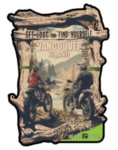
“Get Lost…Find Yourself” Adventure and Dualsport Motorcycle camping weekend. Critter Moto is excited to announce the first annual “Get Lost…Find Yourself” Adventure & Dualsport Motorcycle campout, taking
the Sea to Sky is coming to Nelson!! Thursday ride from Sunshine Coast to Osoyoos (possibly through WA), stay at Osoyoos Hotel & Suites.Friday &

You want the works? Well, here it is! All the tracks, routes, and waypoints in one place. No better way to see the big picture,

Heading up Six Mile Lake and down Lemon Creek is a classic dual-sport ride. The typical loop is just up, down and back on the

Riding the loop around the Kokanee Park is a must do! Travelling through Nelson, Balfour, Kaslo, New Denver and through the Slocan Valley. It has

Ok folks, this one is a classic! A paved, smooth, flowy cruise, it takes the rider through some spectacular scenery. Along the North Shore of

The Pend Oreille River is a tributary of the Columbia River, approximately 130 miles long, in northern Idaho and northeastern Washington in the United States,

Do you like beautiful Lake views? Do you like groomed railbed gravel? Do you like getting around a mountain pass on the pavement? Do you

Discover the Kootenays on a breathtakingly picturesque circle motorcycle tour through the heart of the Selkirks, a 390-kilometre loop that starts and ends in Nelson,

The Buchanan Lookout stands tall at 1,912 m (6,272 Ft) and offers stunning views of the Kootenay Lake, Kokanee Glacier Provincial Park, Goat Range Provincial

The climb to Gray Creek Pass is 5,000 ft of elevation gain in 16.5 km making it the highest dirt pass in Canada! The 6,850